Differences Between WGS84, UTM, and MGRS
Author: Sercan Fidan · Published: 24 Temmuz 2026 · Updated: 2026-07-25 · Harita ve Koordinatlar
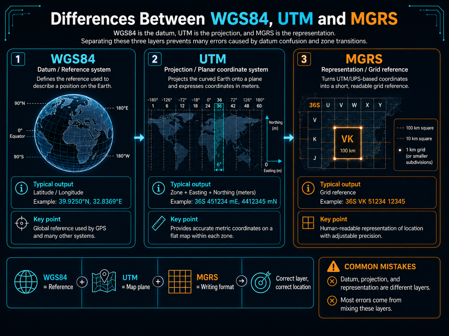
One of the most common confusions I encounter in projects I work on around positioning is this: WGS84, UTM, and MGRS get talked about as if they were three alternatives for the same job. In reality, these three are different layers of the same problem. WGS84 is a reference system that mathematically defines the Earth; UTM is a projection and zone scheme built on top of that reference; MGRS is a representation that converts UTM coordinates into text readable in the field. Talking about them without separating the layers makes both calculation errors and communication mishaps inevitable. In this post, I'll try to place each of the three in its proper role, explain which one is the right tool for which task, and cover the most common mistakes.
WGS84: The Reference on the Ground
WGS84 is actually the name of two things at once: an ellipsoid definition that approximates the shape of the Earth — that is, the datum — and the geographic coordinate system built on that ellipsoid. The latitude and longitude values we read from a GNSS receiver are relative to the WGS84 datum. These values are in degrees; they measure angles, not distances. The meter equivalent of one degree of longitude is about 111 kilometers at the equator, dropping to zero toward the poles. That's why you can't derive the distance between two points directly from the latitude-longitude difference; you need spherical formulas like haversine or a geodesic calculation on the ellipsoid.
Here's the critical part: a latitude-longitude pair is incomplete information unless you state which datum it's relative to. In Turkey, some older maps are based on the ED50 datum, and the same physical point yields different coordinates under ED50 versus WGS84; this difference in Turkey is typically on the order of 100-250 meters. Mixing up datums produces coordinates that look perfectly reasonable on screen but point to the wrong location in the field; it's an insidious source of error, because the values don't look broken.
UTM: A Projection for Working in Meters
UTM is a projection and zoning scheme that unrolls the WGS84 ellipsoid onto a plane. The Earth is divided into 60 longitude zones of 6 degrees each; each zone has its own transverse Mercator projection. The result is easting and northing values in meters. This is a great convenience for engineering calculations: if two points fall in the same zone, the distance between them can be found with simple Pythagoras, and the bearing with plane trigonometry. For short and medium distances, this approach is more than sufficient for most tasks.
But convenience isn't free. The first trap is zone boundaries: if two points fall into different zones, you can't subtract their easting-northing values directly; you first need to convert both to a common zone. The second trap is scale: the projection carries a small but accumulating scale error as you move away from the zone's central meridian. In the desktop tools I've worked on, every distance calculation that didn't explicitly handle zone transitions sooner or later produced a wrong result with data near a boundary. That's why I always carry the zone number as an inseparable part of the coordinate; easting-northing alone is never sufficient.
MGRS: The Language of Talking in the Field
MGRS is a grid reference representation built on top of UTM. An MGRS string starts with the zone number and latitude band letter, followed by two letters identifying the 100-kilometer square, and ends with digits that determine precision. For example, the string "35T PF 12345 67890" points to a 1-meter square with 5+5 digits; 4+4 digits means 10 meters, 3+3 digits means 100 meters. Precision is read from the length of the representation; whoever is reporting embeds how confident they are right into the string itself. MGRS's real value lies not in calculation but in communication: it can be read aloud over radio, written on paper, and remembered in chunks. But numerical calculation isn't done on MGRS itself; you decode the string, calculate in UTM or geographic coordinates, and re-encode the result into MGRS if needed. MGRS isn't a coordinate system — it's a coordinate packaged for humans.
A coordinate is not a number but a contract; I never report a value without stating its datum and zone, and I never use one without asking if they haven't been stated.
- Distance and bearing calculation: use plane geometry if the points are in the same UTM zone and the distance is short; use geodesic calculation on WGS84 for long distances.
- Data storage and map display: store data as WGS84 latitude-longitude, and convert to the required projection at display time.
- Field reporting and verbal communication: use MGRS; choose the digit count according to the precision the task requires.
- If you're working near a zone boundary, fix all points to a single zone before starting the calculation.
- For coordinates coming from different sources, verify the datum before starting the calculation; a datum mismatch doesn't make the values look broken, but it can shift the point by hundreds of meters in the field.
In summary: WGS84 is the definition of the ground, UTM is the plane we work on, and MGRS is the language we speak. The three aren't competitors but overlapping layers. On the software side, my habit is to keep the internal representation in a single system, usually WGS84; to gather conversions into a single module; and to carry the datum and zone information alongside every coordinate as part of the data structure. That way, I can show that a value that looks correct on screen is also correct in the field; and I don't trust a result myself if I can't demonstrate that.
